
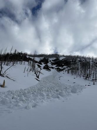
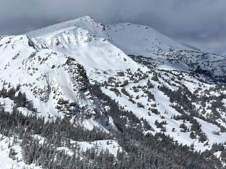
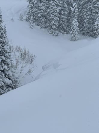
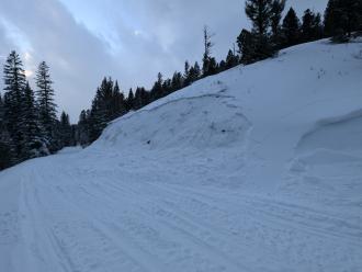
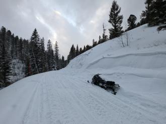
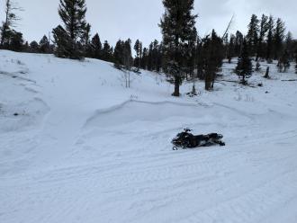
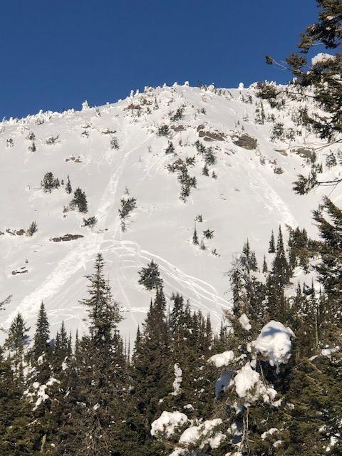
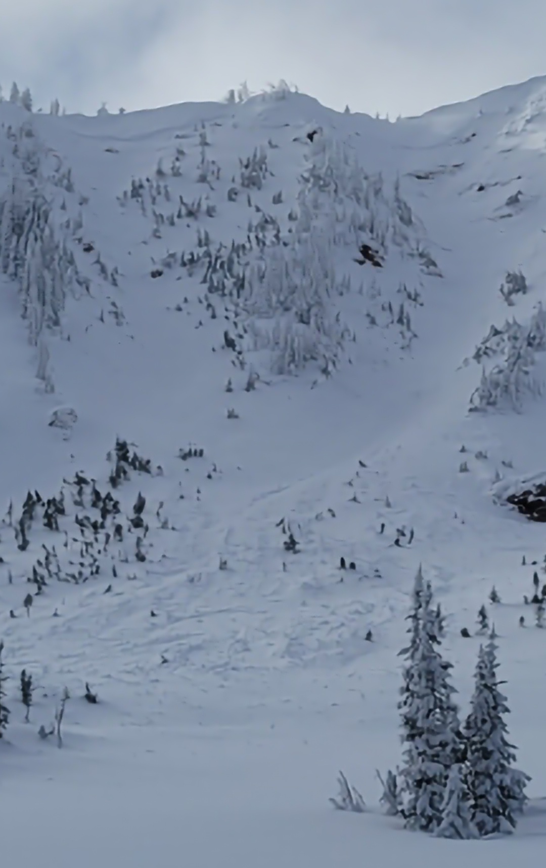
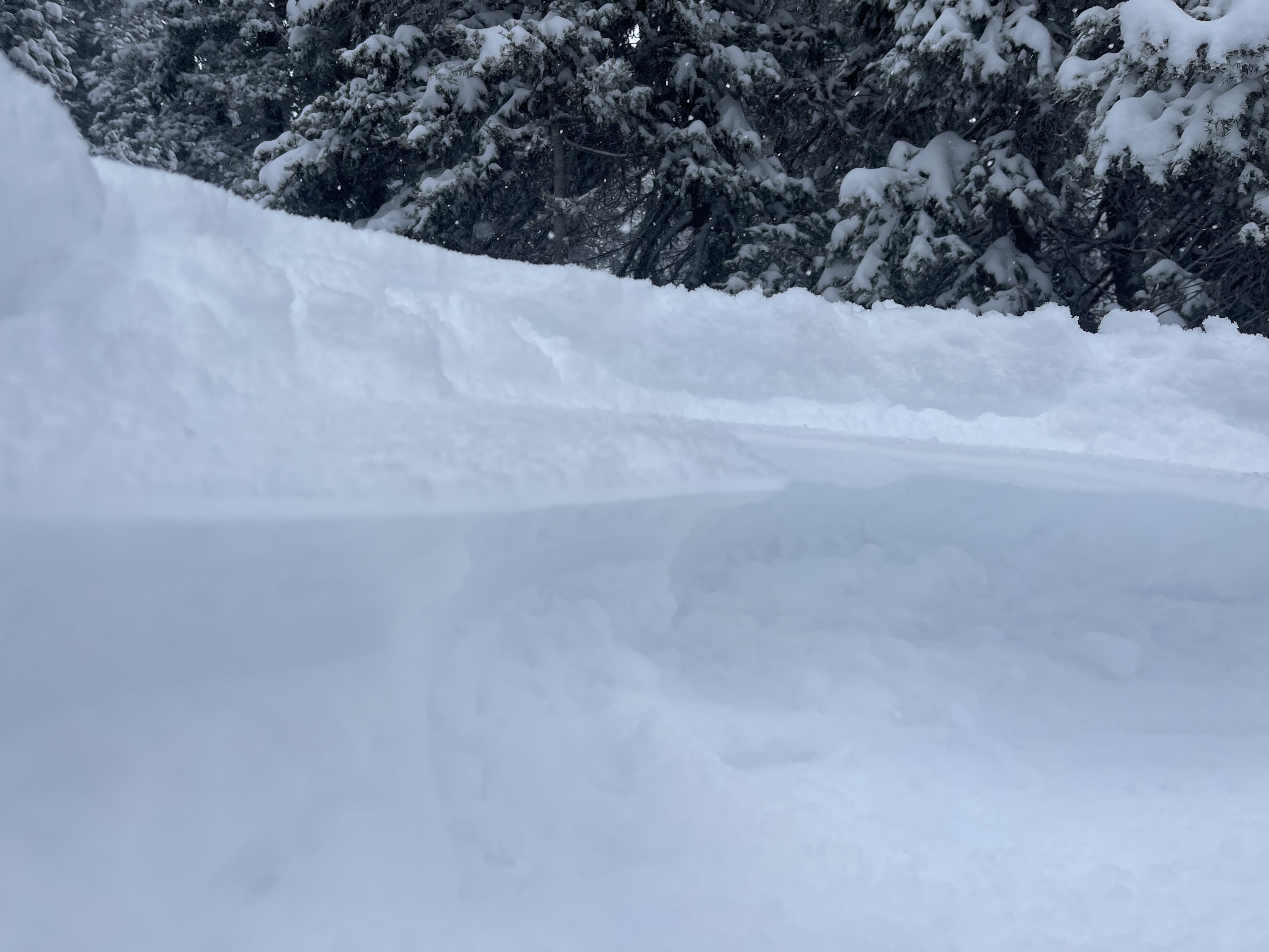
This wet loose avalanche is a great example of where they often occur. Rocks absorb extra heat from the sun and can quickly melt and destabilize the snow. Either move under areas like this early in the morning (as we did), or if you have to travel under them later in the day, move quickly.
Trip Planning for Island Park

Primary Problem: None
Bottom Line: Spring weather can be highly variable and create a mix of avalanche problems to watch out for. Snow conditions and snow stability can change drastically from day to day or hour to hour. Anticipate rapid change and plan accordingly. Plenty of snowfall over the winter with more spring snow to come makes avalanches possible into summer.Past 5 Days
Mon Apr 21

None
None
Fri Apr 25
None
None
Mon Apr 28
None
None
Fri May 2
None
None
Mon May 5
None
None
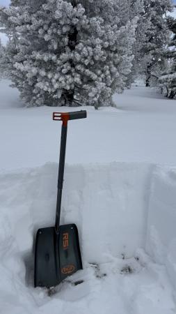
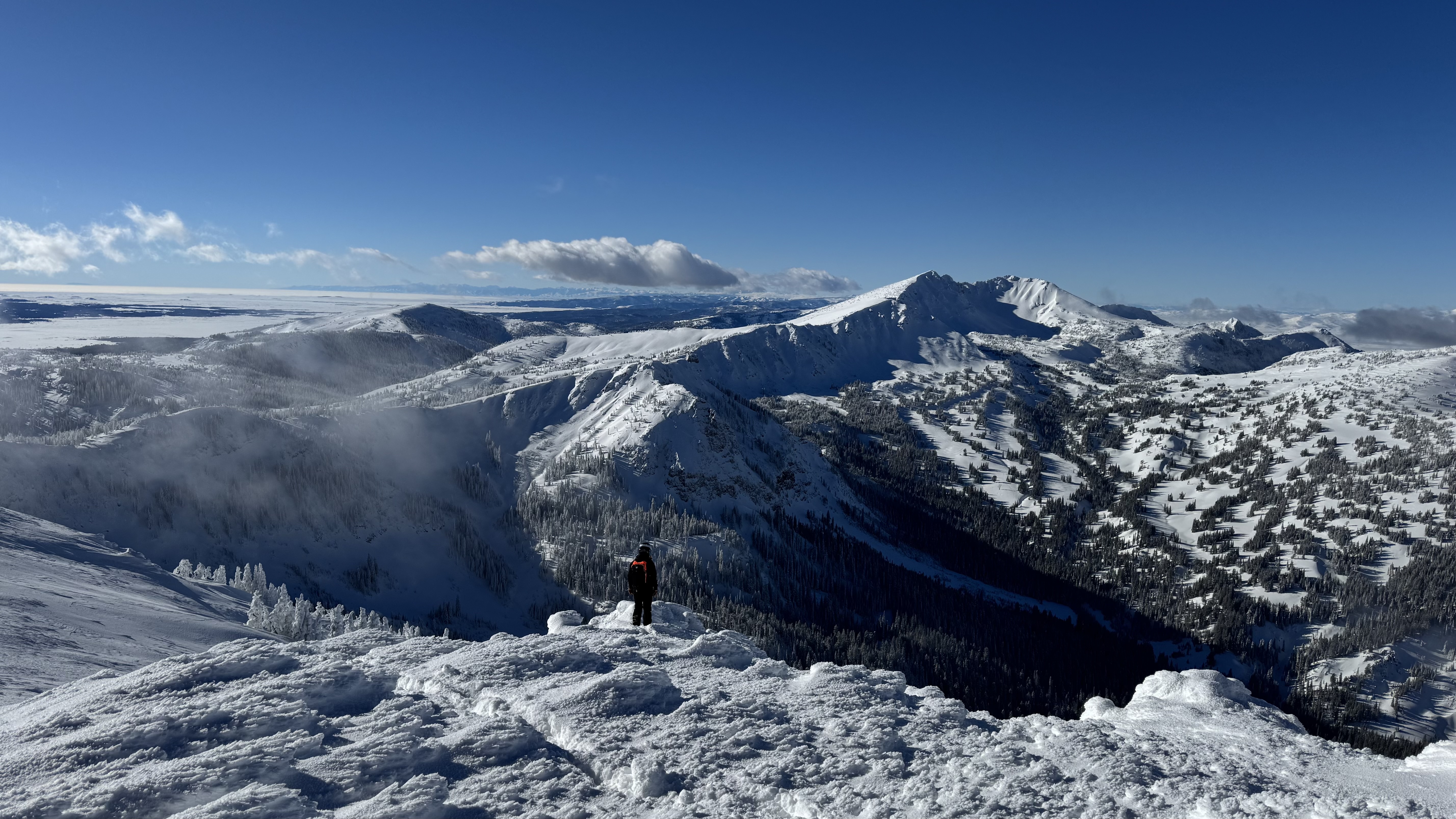
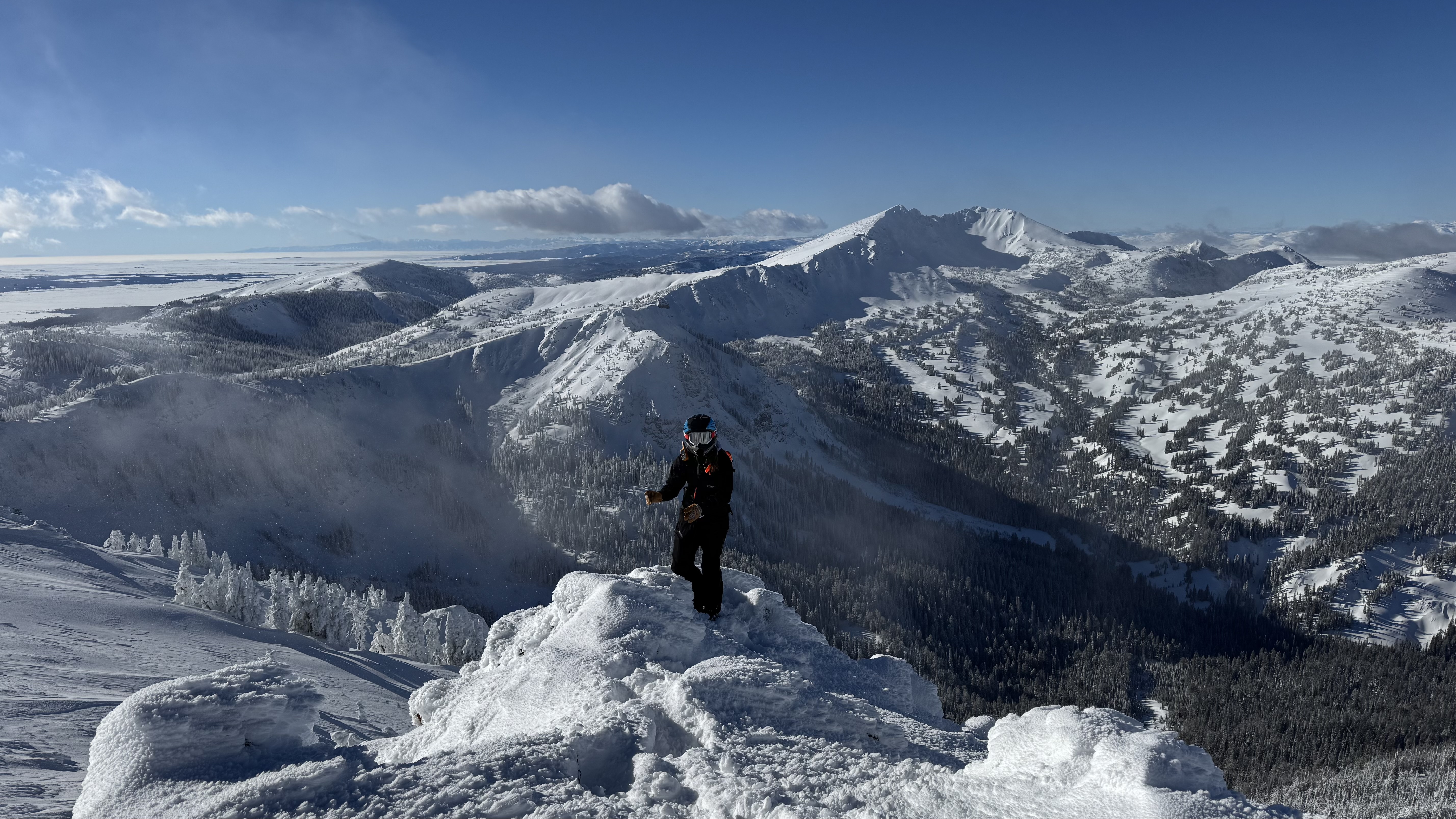
Relevant Photos
Displaying 1 - 40
-
-

Understanding Avalanche Safety Preparedness – 5-Minute Survey for Motorized Users
We need your input! Eastern Oregon University is conducting a survey to better understand avalanche safety preparedness among motorized backcountry users like you. Your feedback will help us learn more about who is purchasing and practicing with avalanche rescue gear (beacon, probe, shovel) and participating in avalanche education—and why some riders aren’t. The survey is confidential and anonymous.
Your feedback is invaluable in improving avalanche education and awareness. Please take a moment to share your experience and help us make a difference.
https://eoustmhs.qualtrics.com/jfe/form/SV_3L8QKAuZzcxJBLo
Thank you for your time and for being a part of this important effort!
-
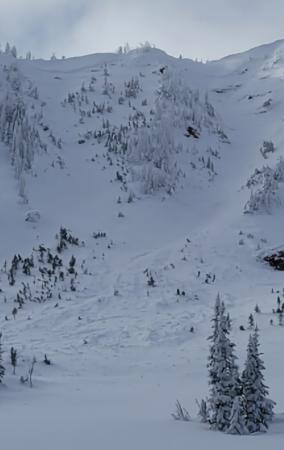
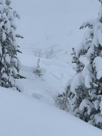
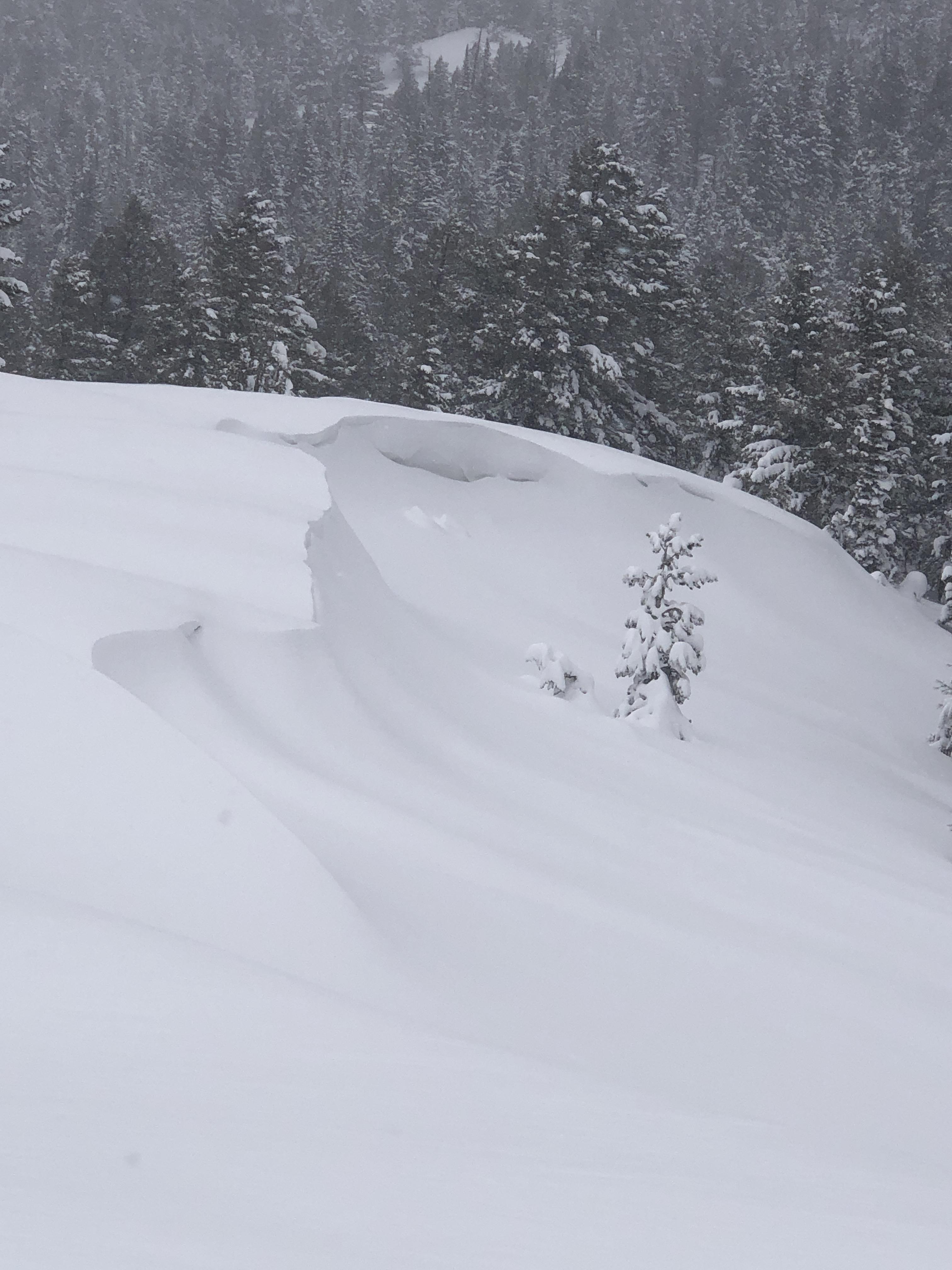
All elevations in Island Park experienced heavy snowfall combined with high winds,this made for unstable wind slabs and cornices. Photo: K Allred
-

We saw a handful of avalanches above treeline terrain that seemed to be wind slabs. However wind and snow had obscured them and I suspect there had been a lot more.
-

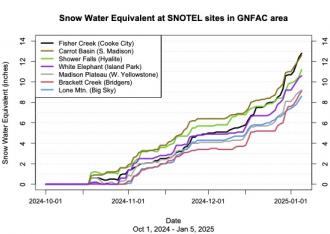
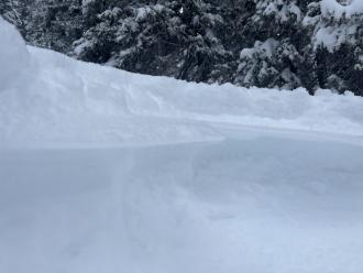
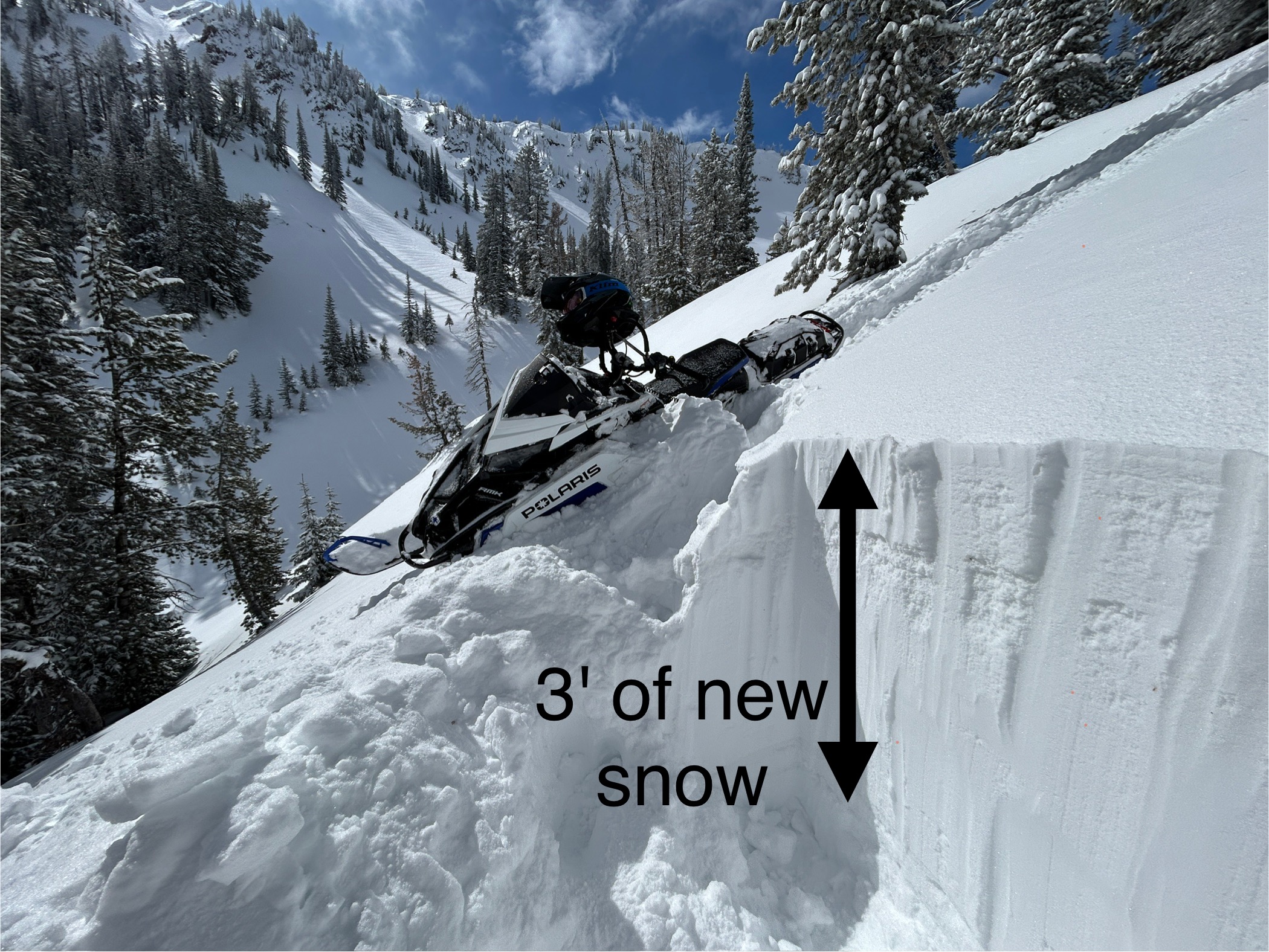
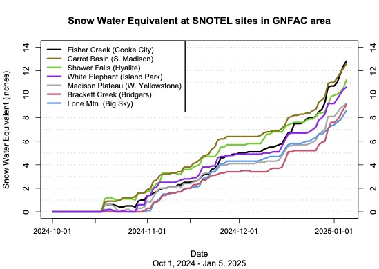
In the last five days, this area has received snowfall containing 4.5-5.3 inches of water which has settled to about 3 feet of new snow.
-

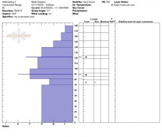
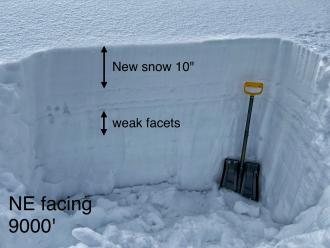
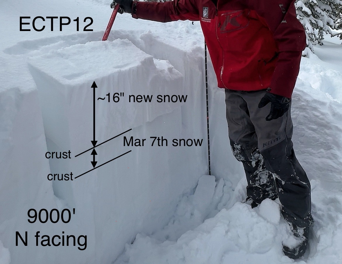
Stability tests continually fractured on old, broken snowflakes just under a crust under the new snow about 16" deep
-
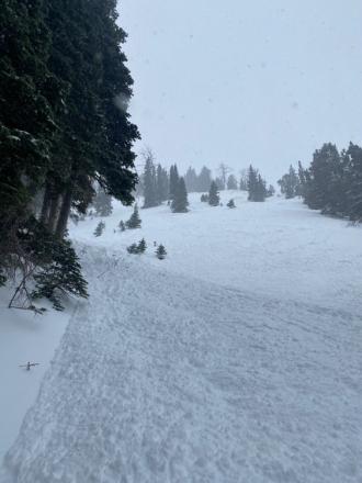
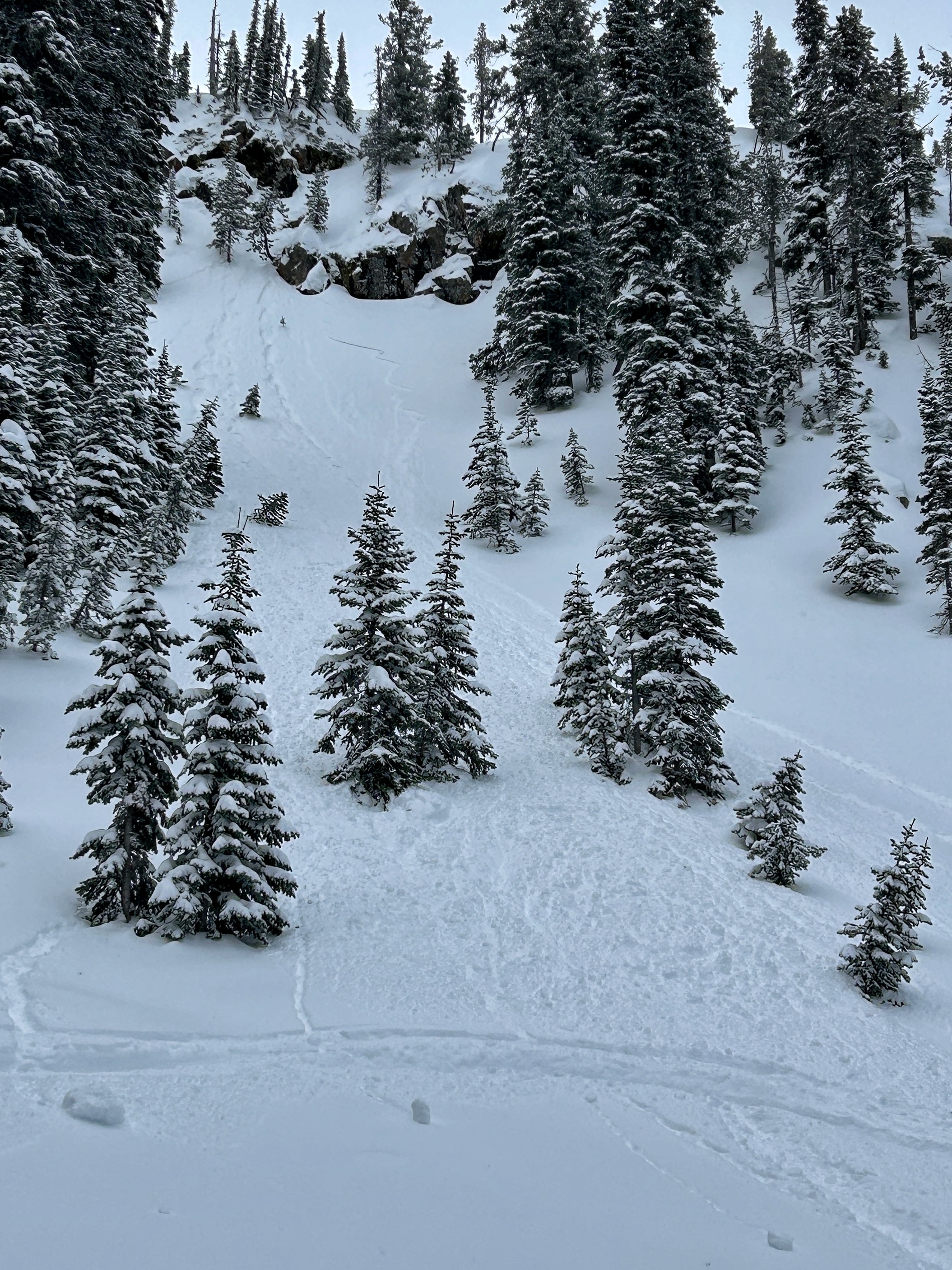
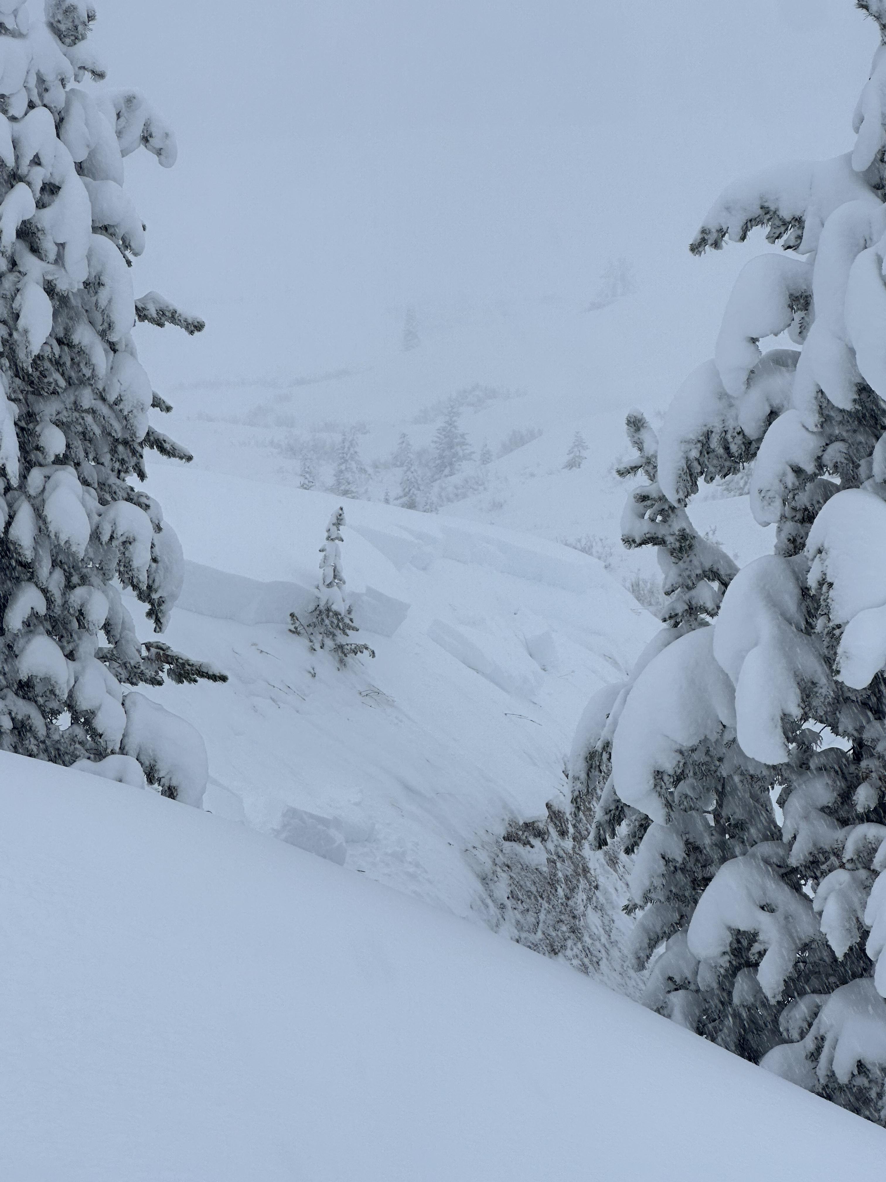
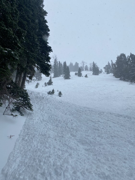
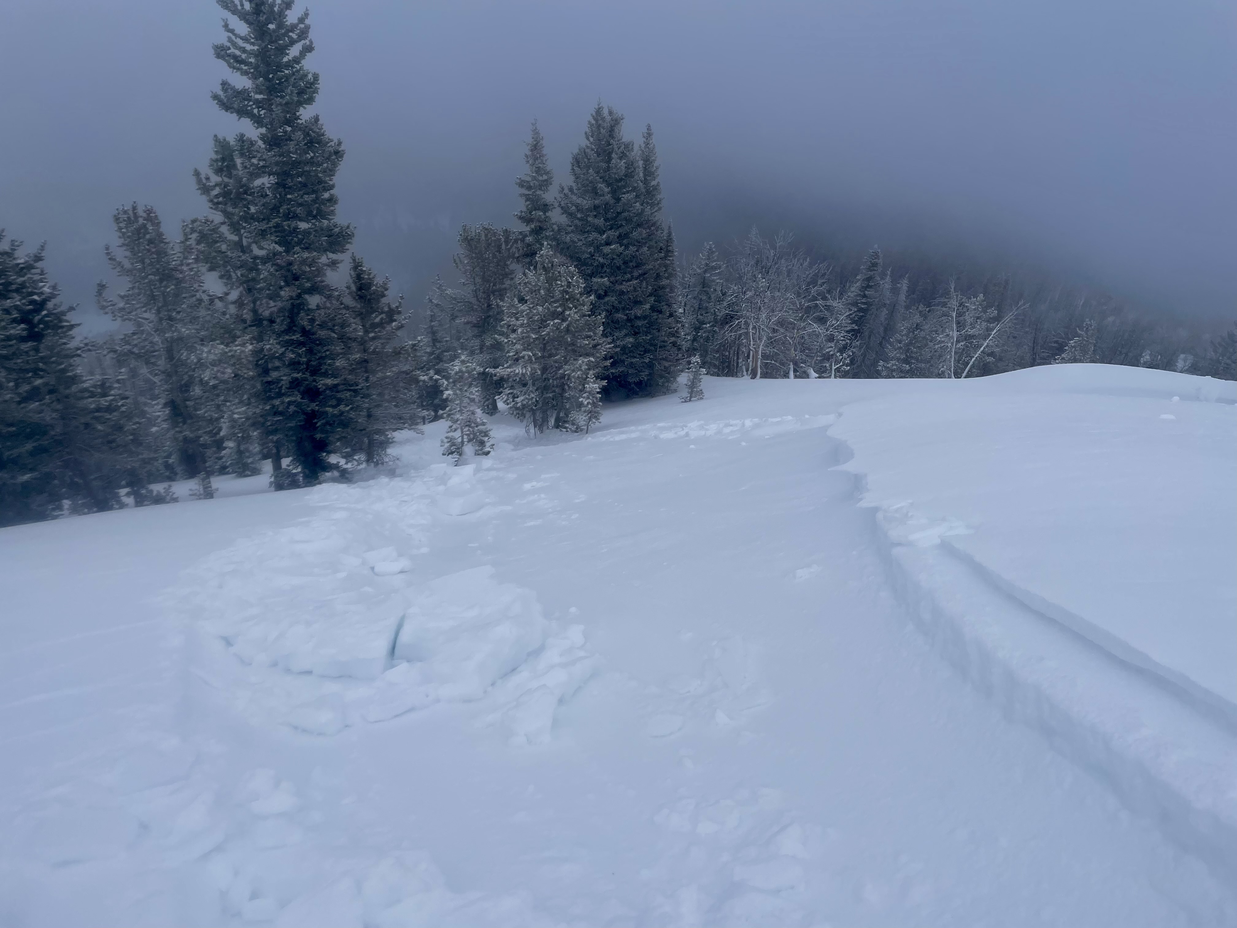
Small natural storm slab
-
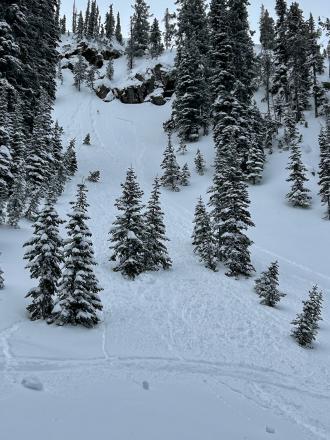
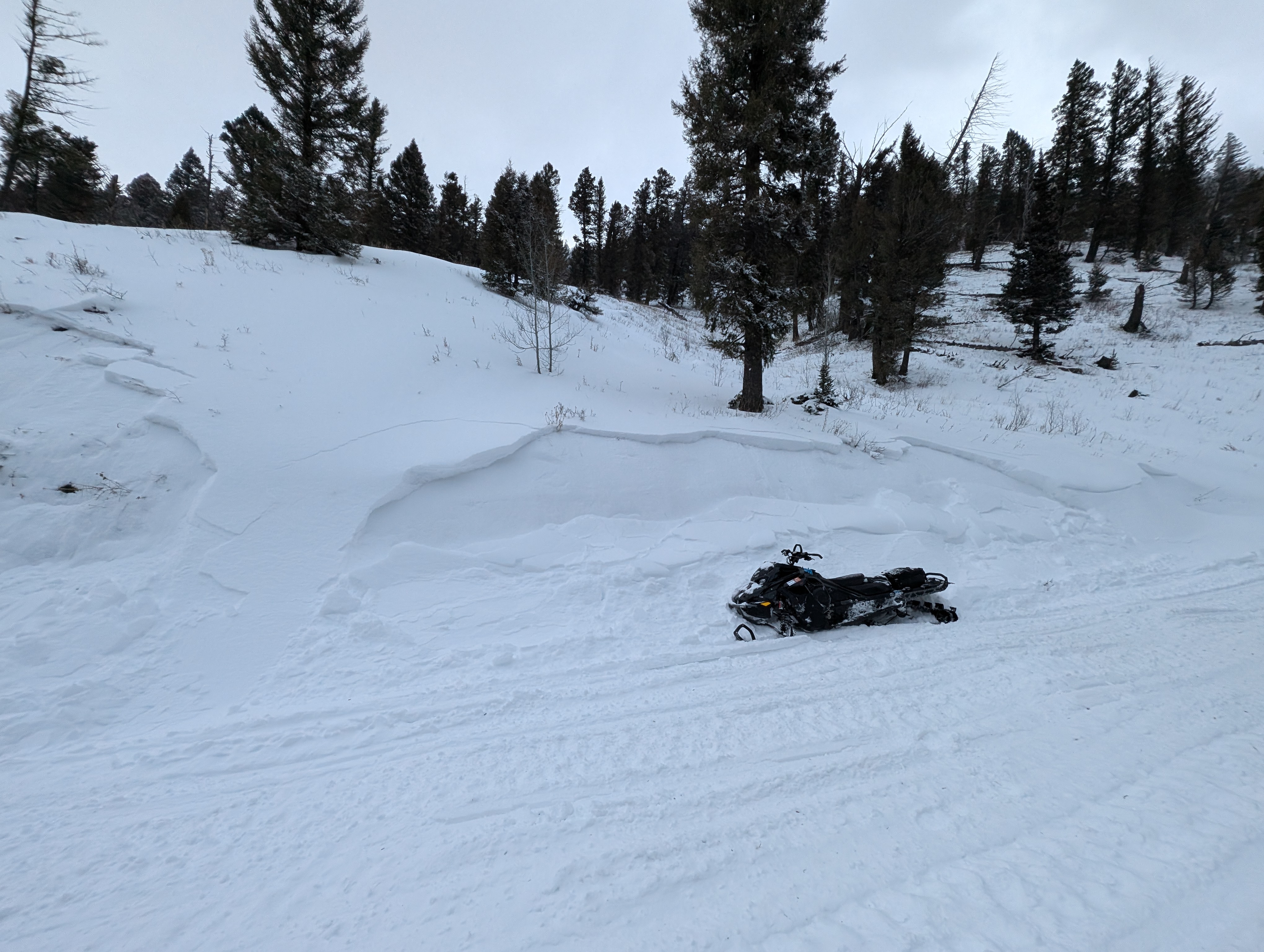
This avalanche started on a slope above the rocks where there was more wind and then triggered another storm slab in the trees. It created a significant debris pile.
-
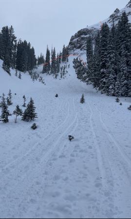
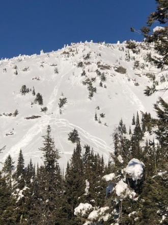
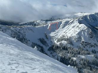
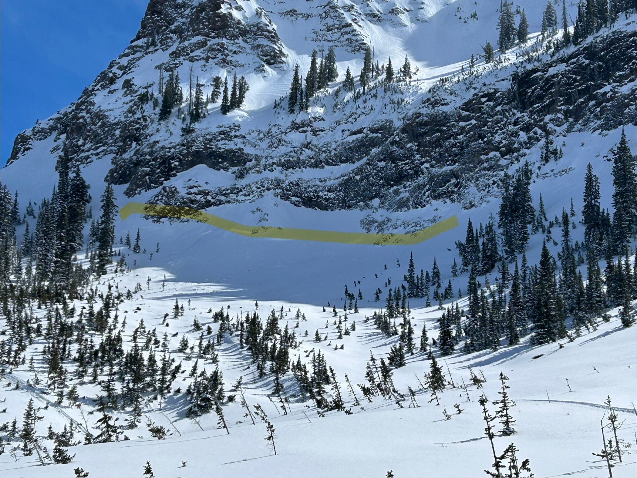
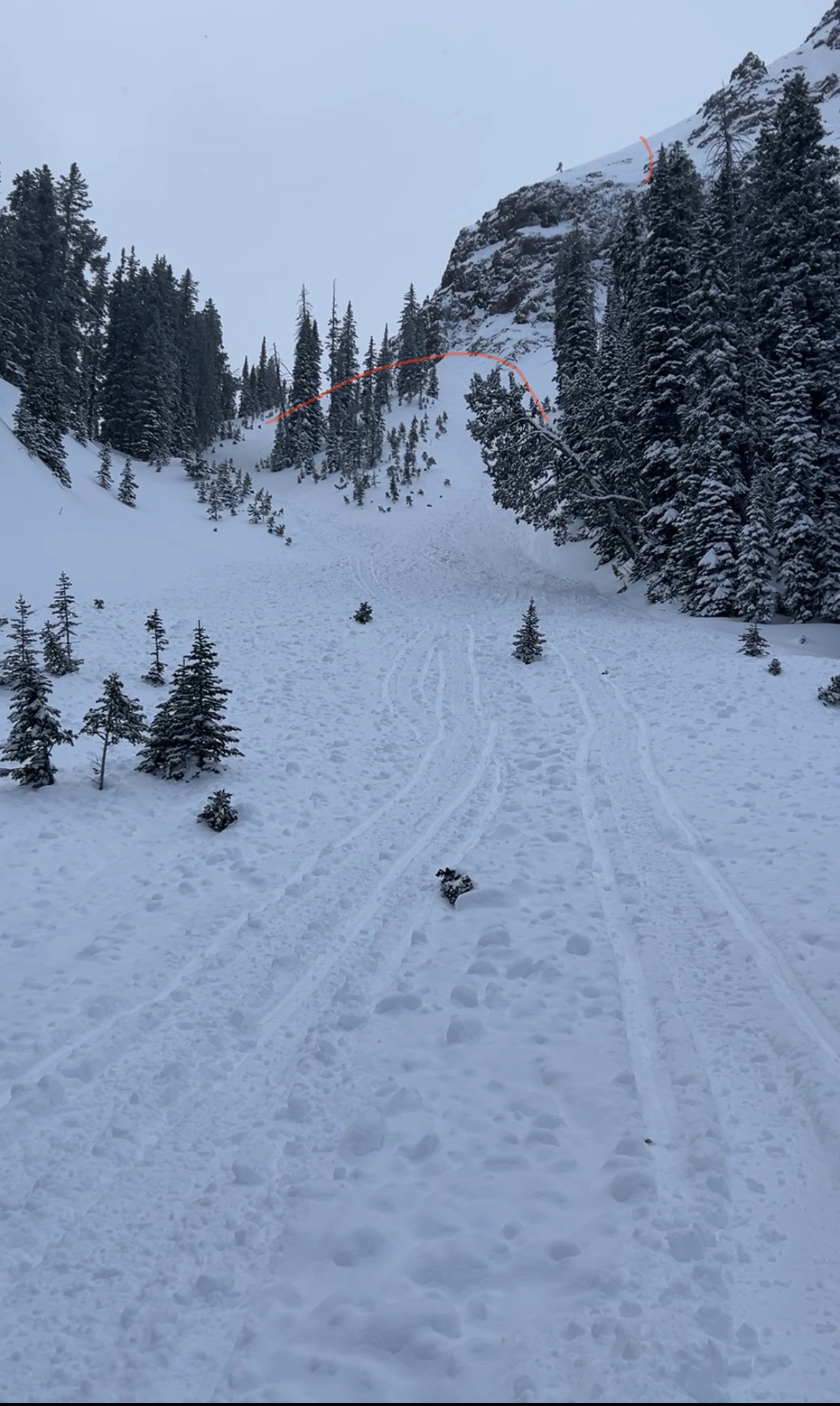
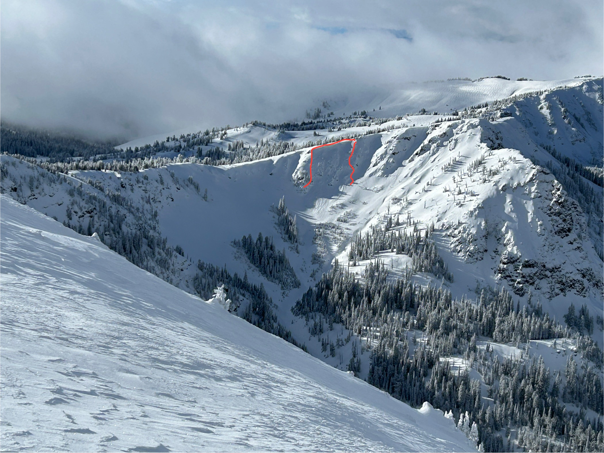
Light red lines indicate crown faces of this natural avalanche. It likely started as a wind slab/storm slab above the rocks, then dropped down onto the slope below triggering a storm slab avalanche that entrained a significant amount of snow and created a big debris pile.
-
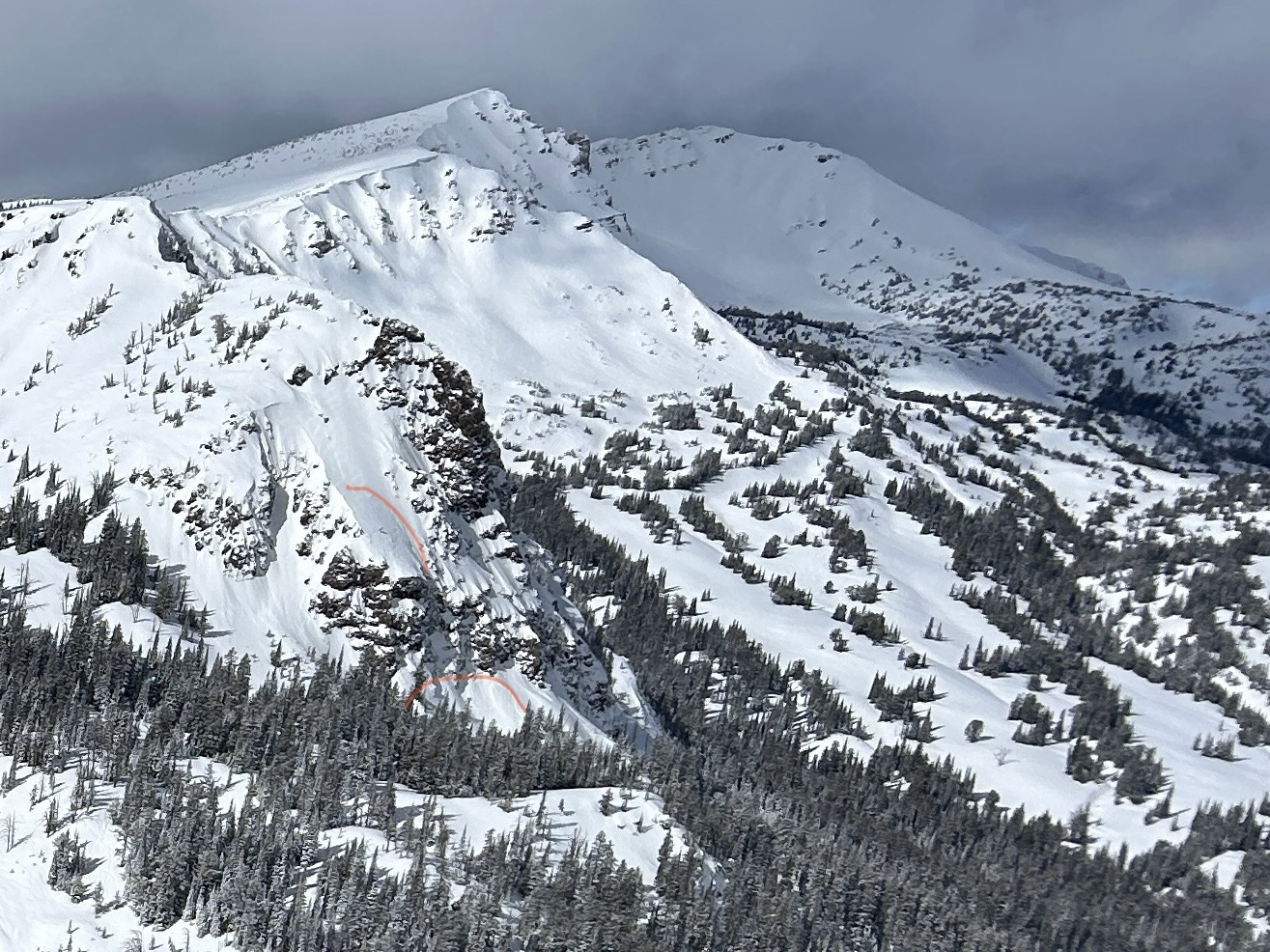
Two Point release avalanches on south slope of Two Top. 1/30/25. Photo: K. Allred
-

Wide spread layer of Surface Hoar mid and upper elevations Two Top area
-
Shooting crack in a fresh wind slab near Mt Jefferson
-
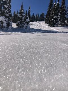
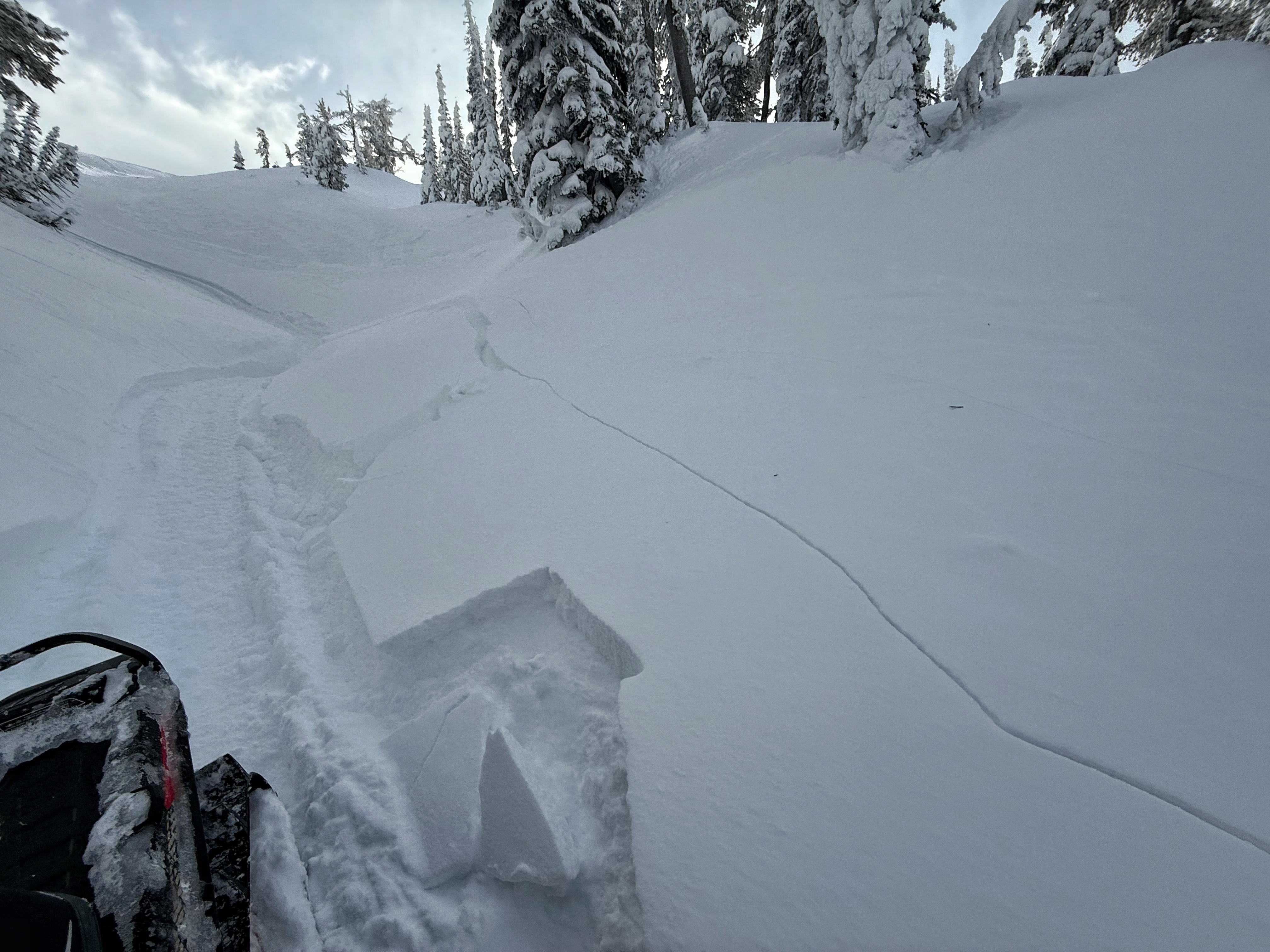
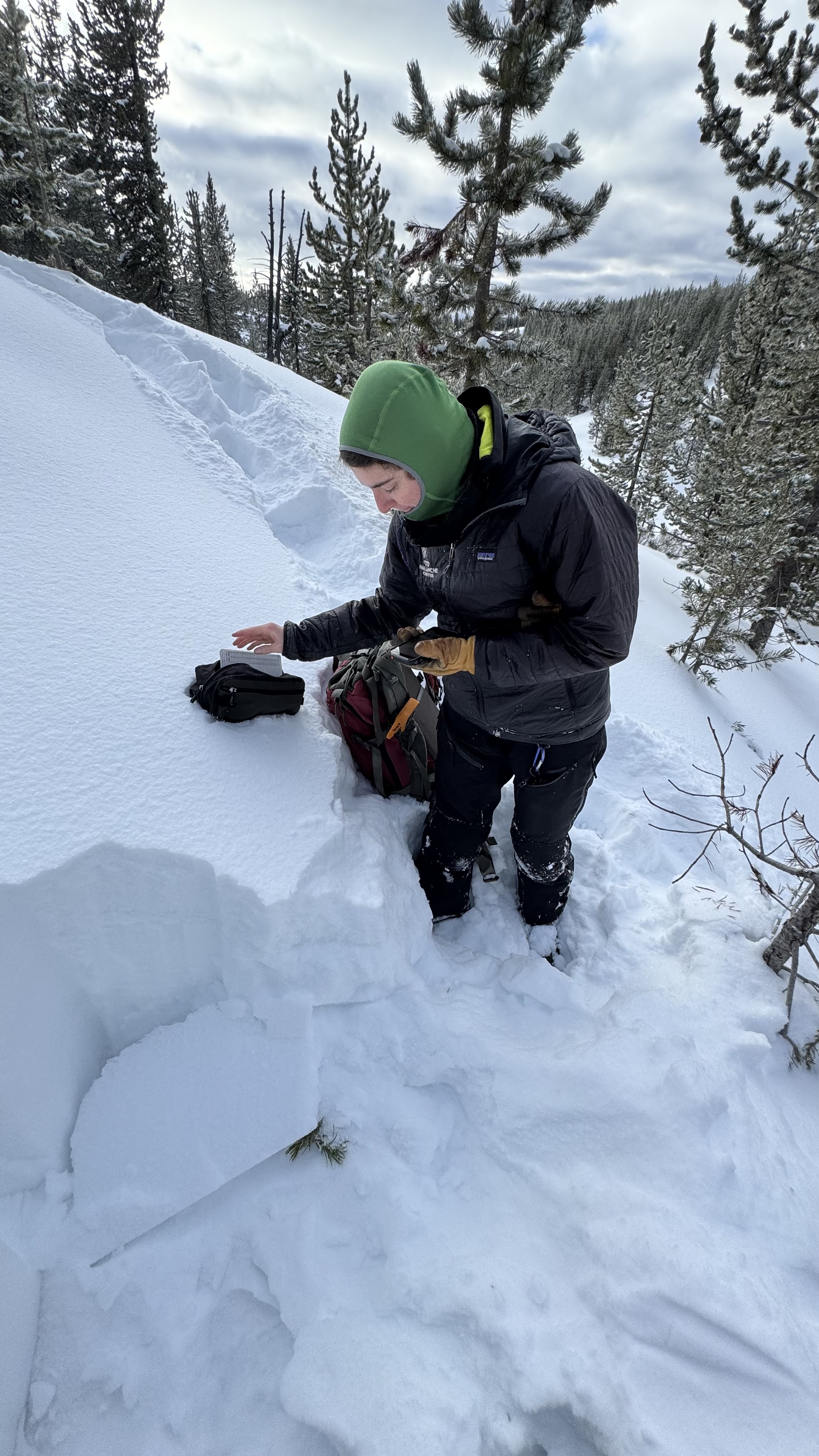
North facing pit in Hellroaring Creek, Centennials
-
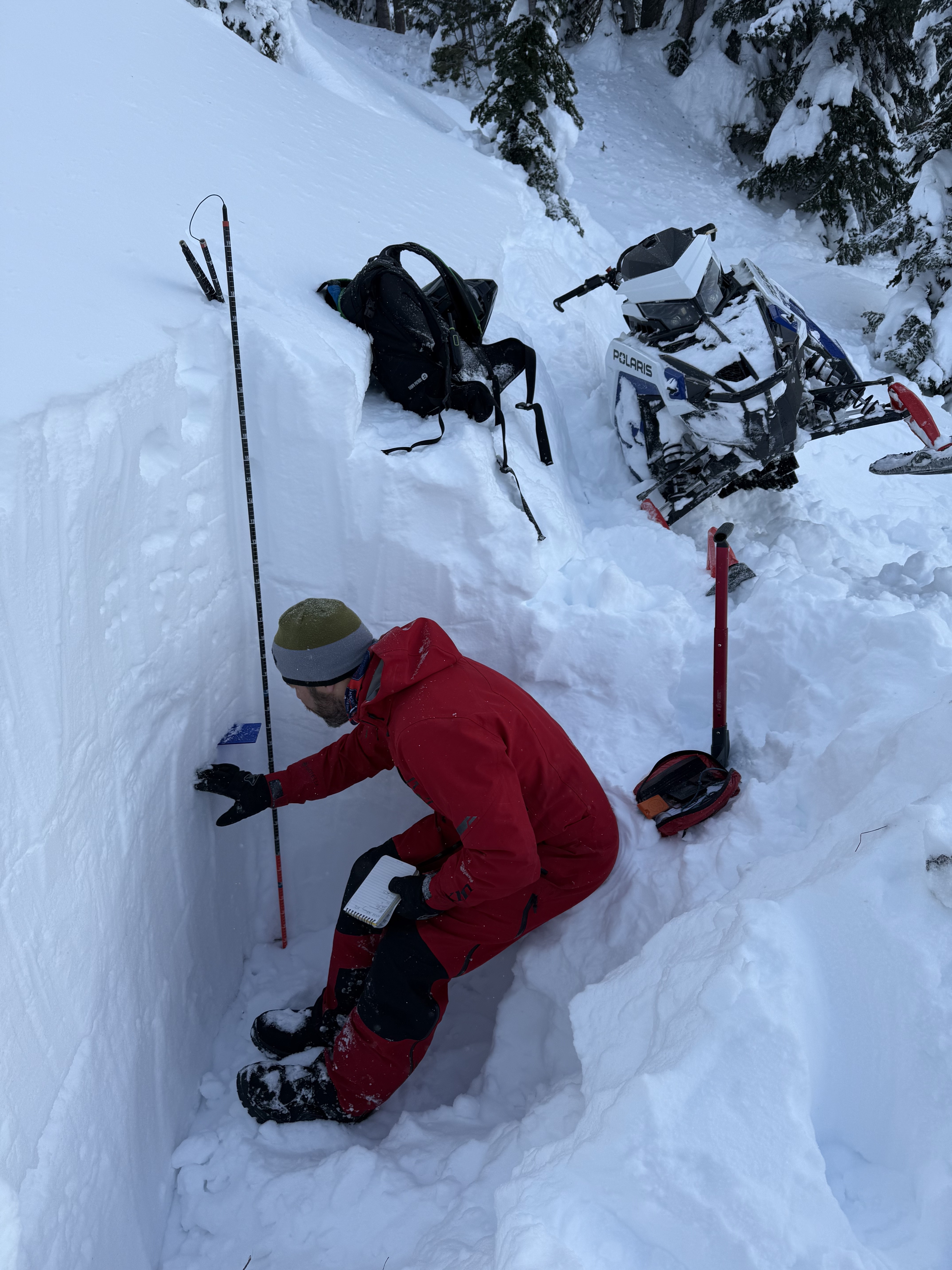
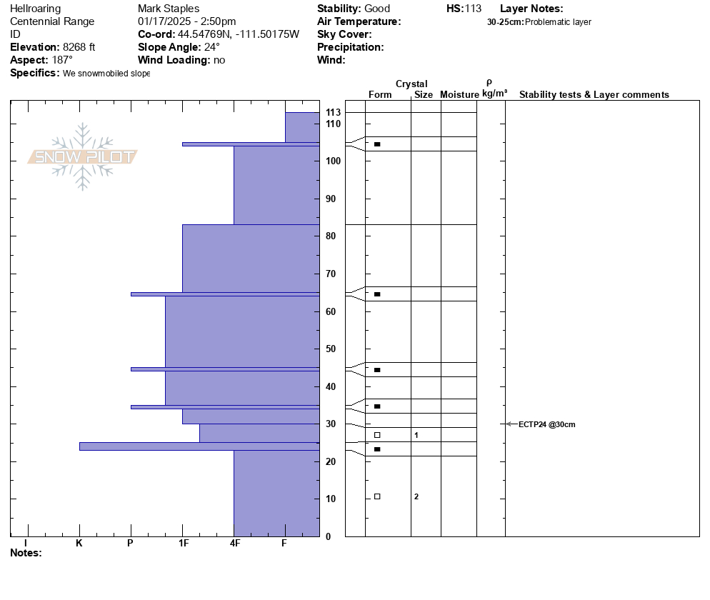
North facing snow profile Hellroaring Creek, Centennials
-
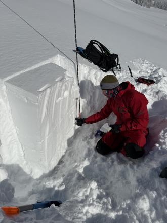
South facing snowpit Hellroaring creek, Centennials
-

S facing snow profile from Hellroaring Creek in Centennials
-

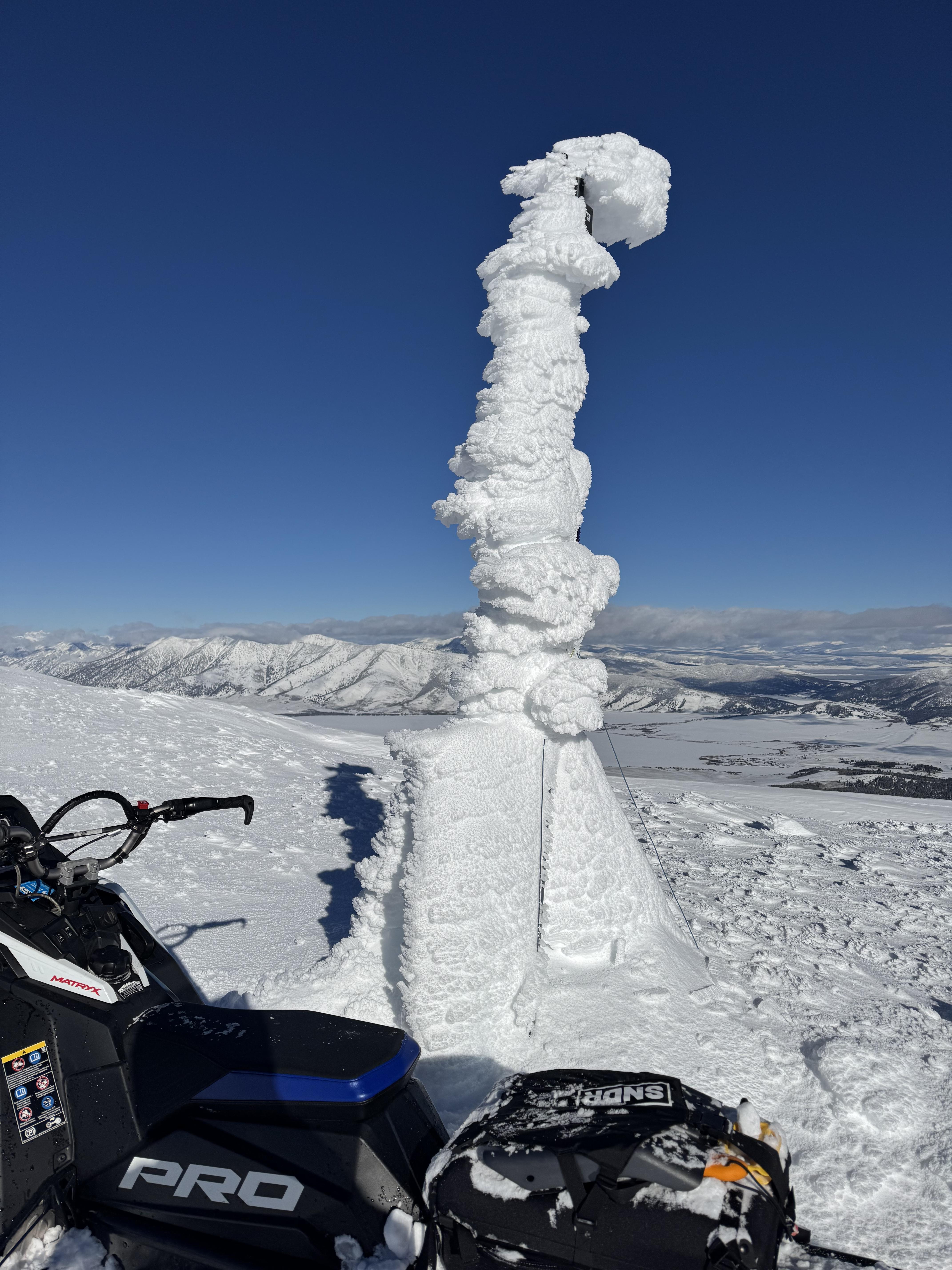
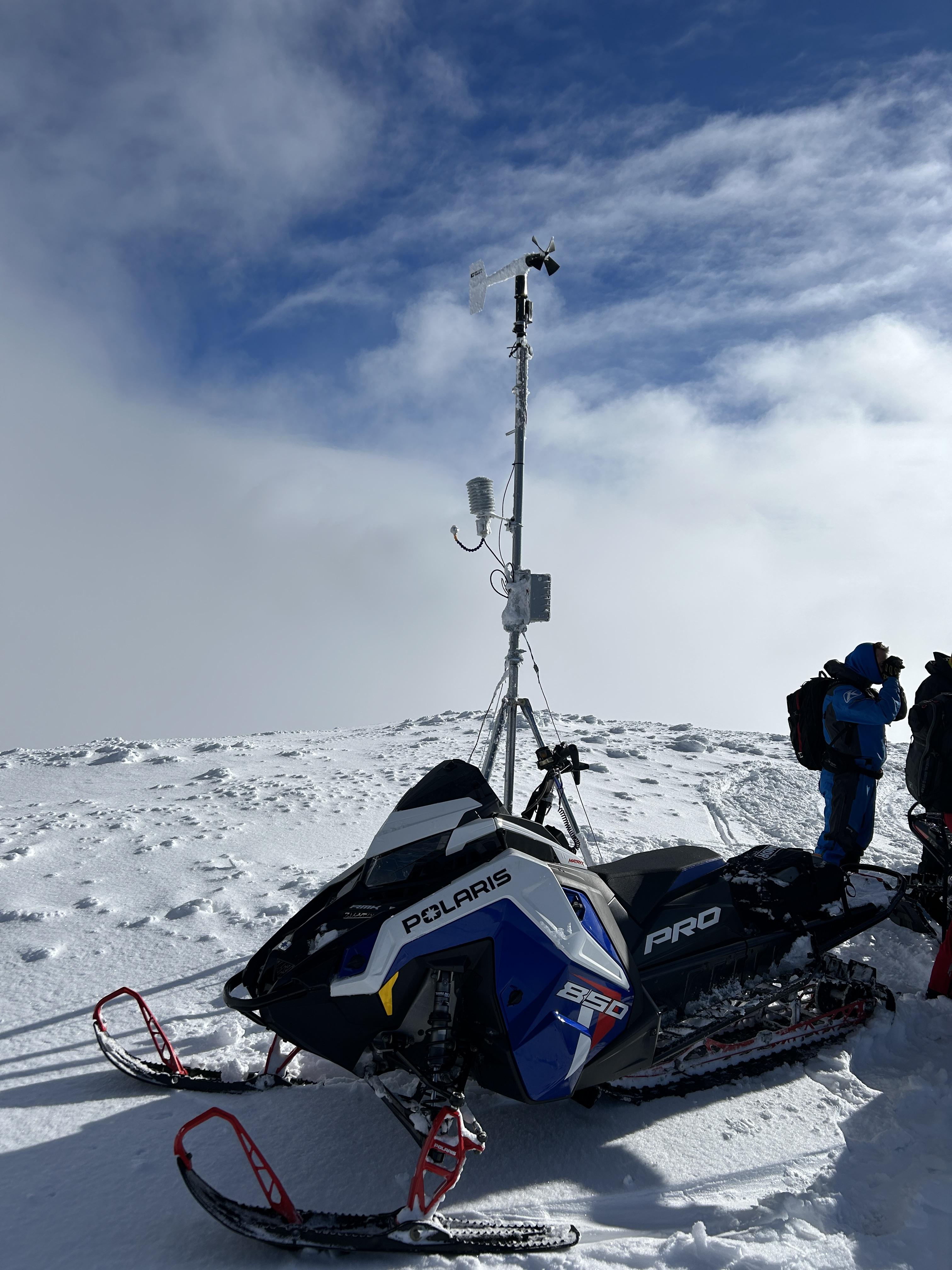
The GNFAC weather station at the top of Sawtelle provides wind, temperature and relative humidity information for forecasting (when it's not covered in a foot of rime ice. Photo: GNFAC
-
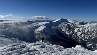
Photo: GNFAC
-
From the top of Sawtelle. Photo: GNFAC
-
Riders in the Centennial Mountains experienced almost constant whumphing at higher elevation and saw a couple of days old avalanche on a windl-oaded east north east facing slope. Photo: R. Gravett
-
-
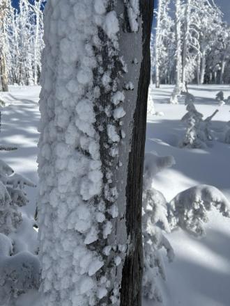
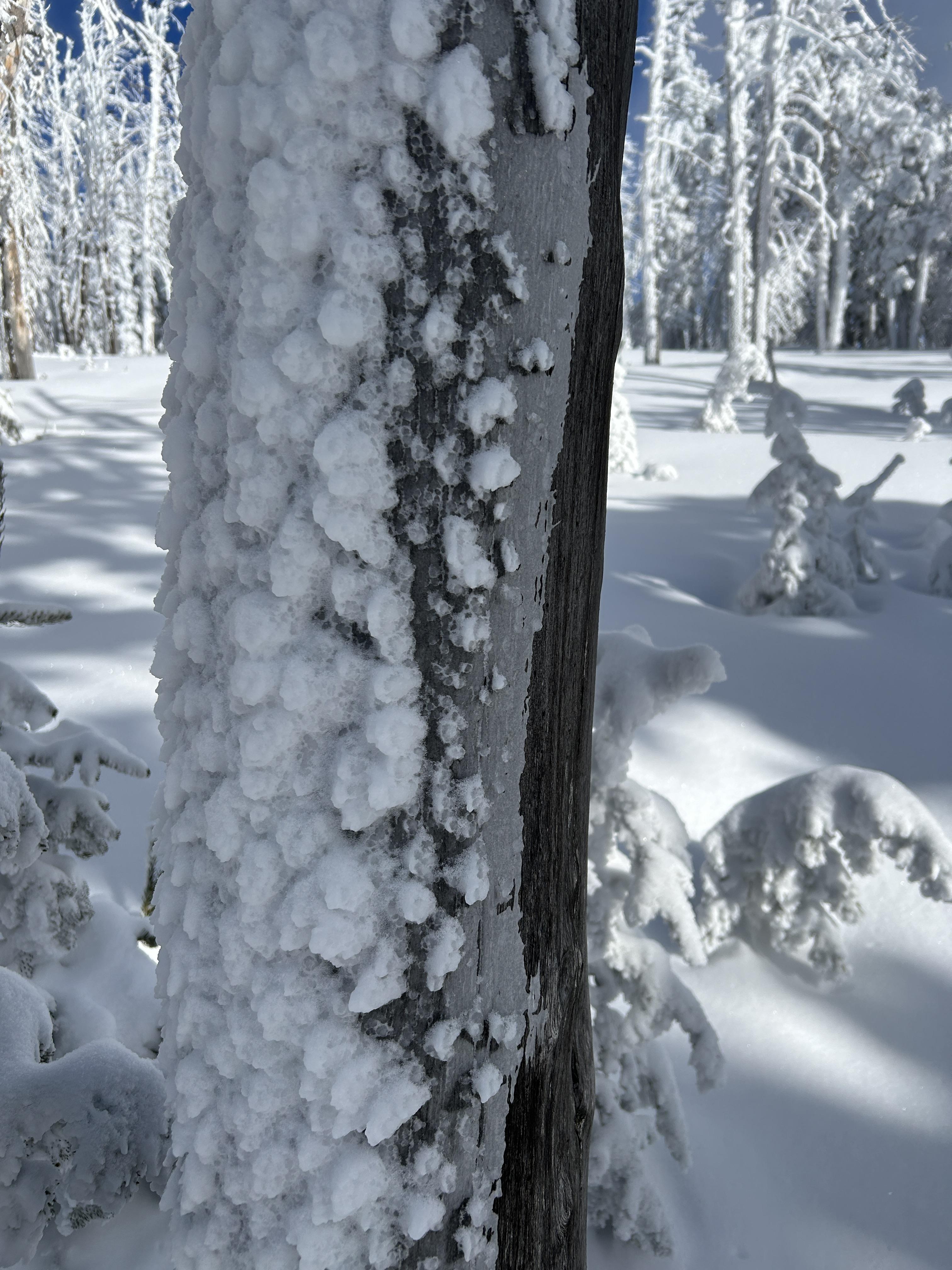
Ice crust on trees from freezing rain last Saturday Dec 28 now covered by rime ice.
-
From obs on 12/29: "On our way out near the cabin I cut a line close to a creek to see if I could trigger something."
-
From obs on 12/29: "On our way out near the cabin I cut a line close to a creek to see if I could trigger something."
-
Thick and robust ice crust layer widespread above white elephant. Photo: Ride Rasmussen Style
-
-
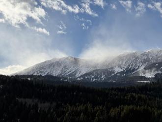
Plumes of drifting snow in the Bridger Range as strong winds blasted the mountains. Photo: GNFAC
-
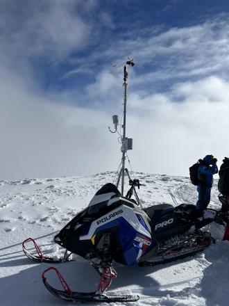
De-rimed Sawtell anemometer
-
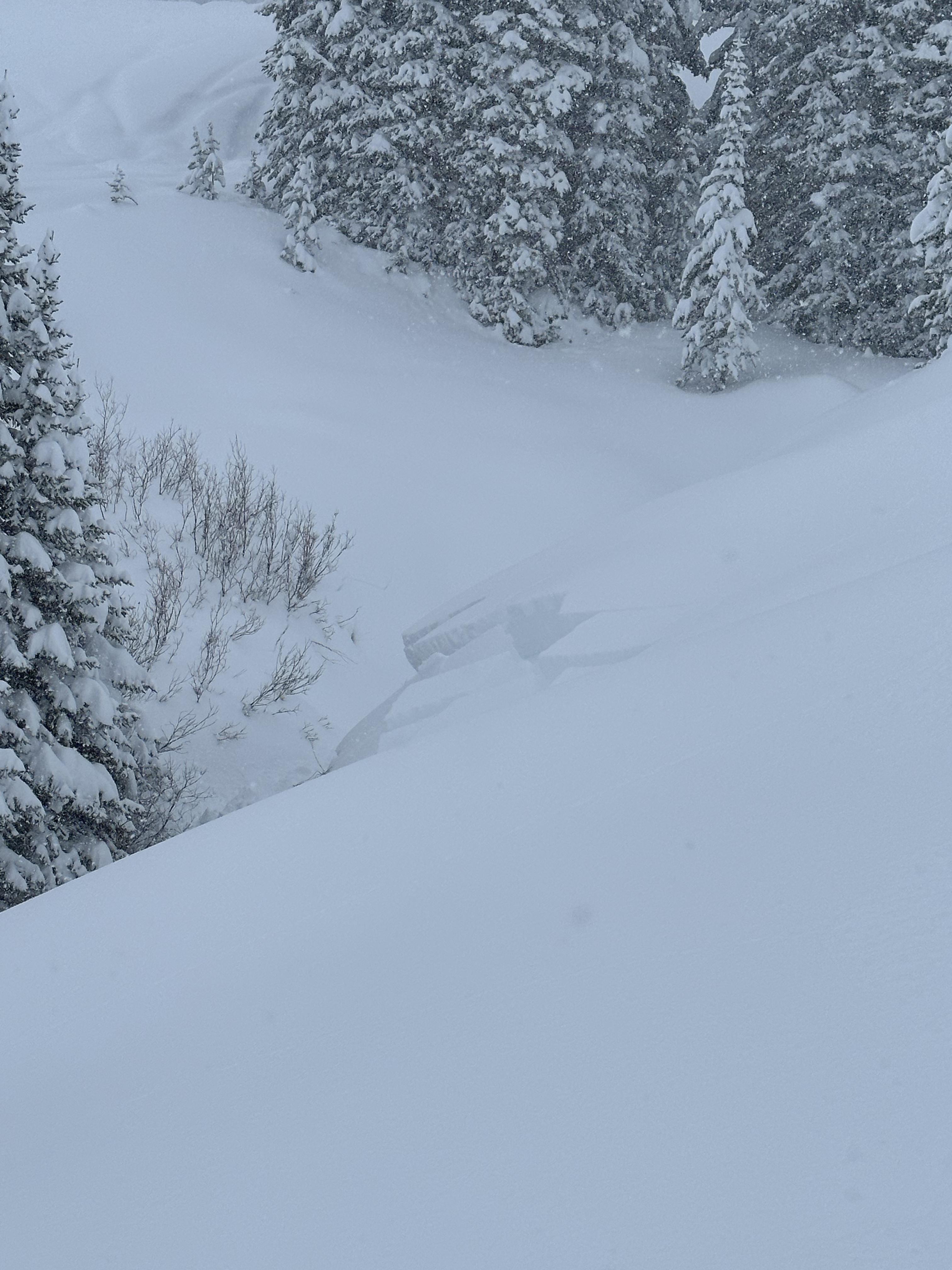
Rock Creek natural avalanche
-
NE facing IP snowpit
-

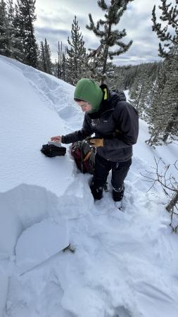
E facing IP snowpit
-
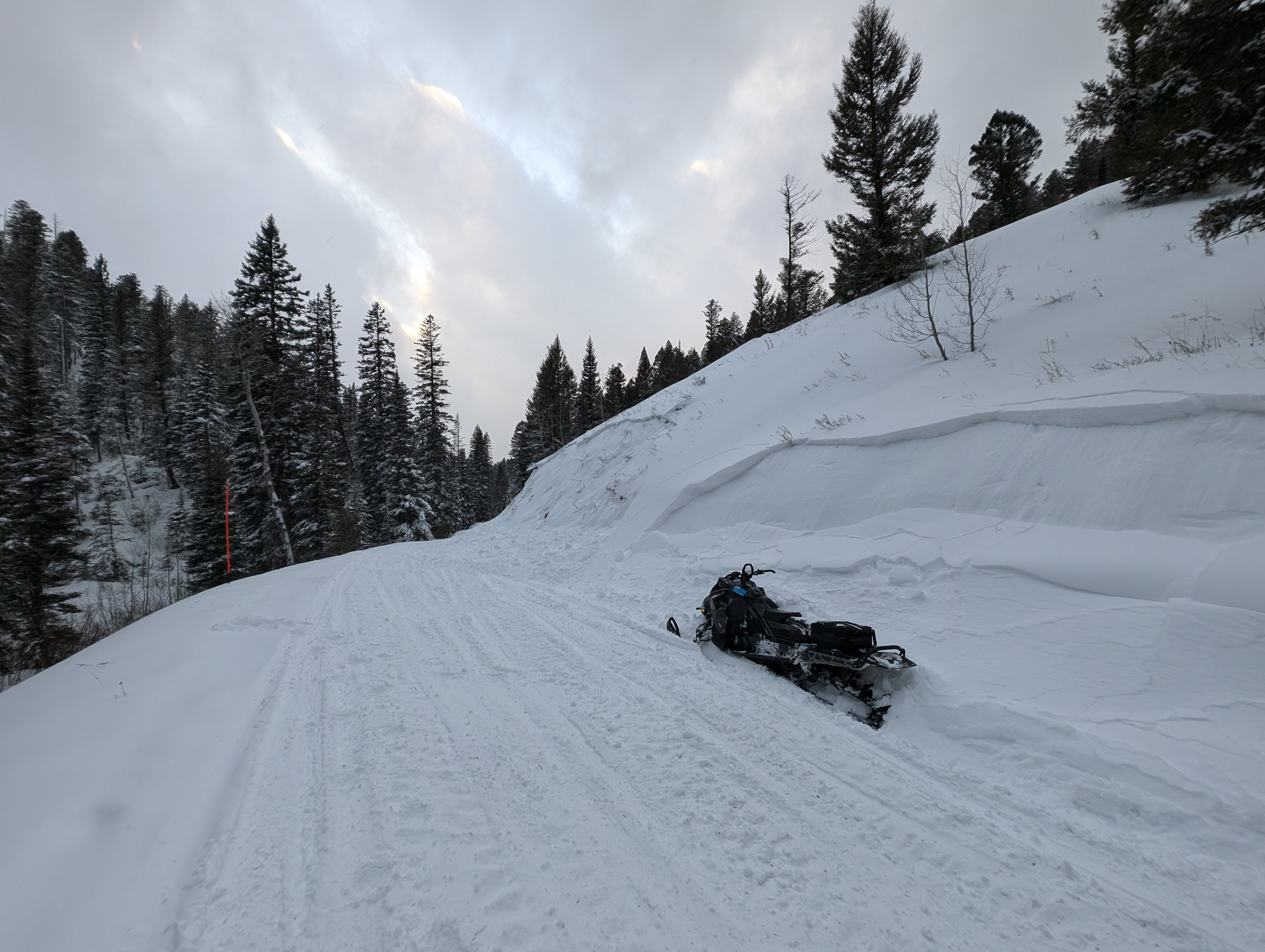
From IG: On 12/15 "Storm slab broke about 200’ above us as skinning up the hallway coming from the north side on the throne." Photo: Anonymous
-
Small windslab triggered on approach for inspection. Failure interface had 5 mm Surface Hoar. Soft slab, remote propagation onto the adjacent slope. Debris covered about half of the road bed.
Photo: J Hambelton
-
Small windslab triggered on approach for inspection. Failure interface had 5 mm Surface Hoar. Soft slab, remote propagation onto the adjacent slope. Debris covered about half of the road bed.
Photo: J Hambelton
-
Small windslab triggered on approach for inspection. Failure interface had 5 mm Surface Hoar. Soft slab, remote propagation onto the adjacent slope. Debris covered about half of the road bed.
Photo: J Hambelton
-
Gusty winds transporting snow in Taylor Fork on Saturday. Triggered a 4-5 inch deep wind slab that propagated about 50 ft at the top of a north east facing slope at 9,500 ft.
Photo: JP
-
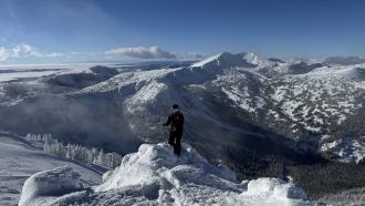
We are grateful for our partnership with the Friends of the Gallatin National Forest Avalanche Center. It is always a good time to get out in the field with our education coordinator, Shannon. Photo: GNFAC
-
The snow depth was 60-70 cm (2-2.5 feet) at the upper elevations of the Big Springs Loop around the Black Canyon area in Island Park. Photo: GNFAC
-
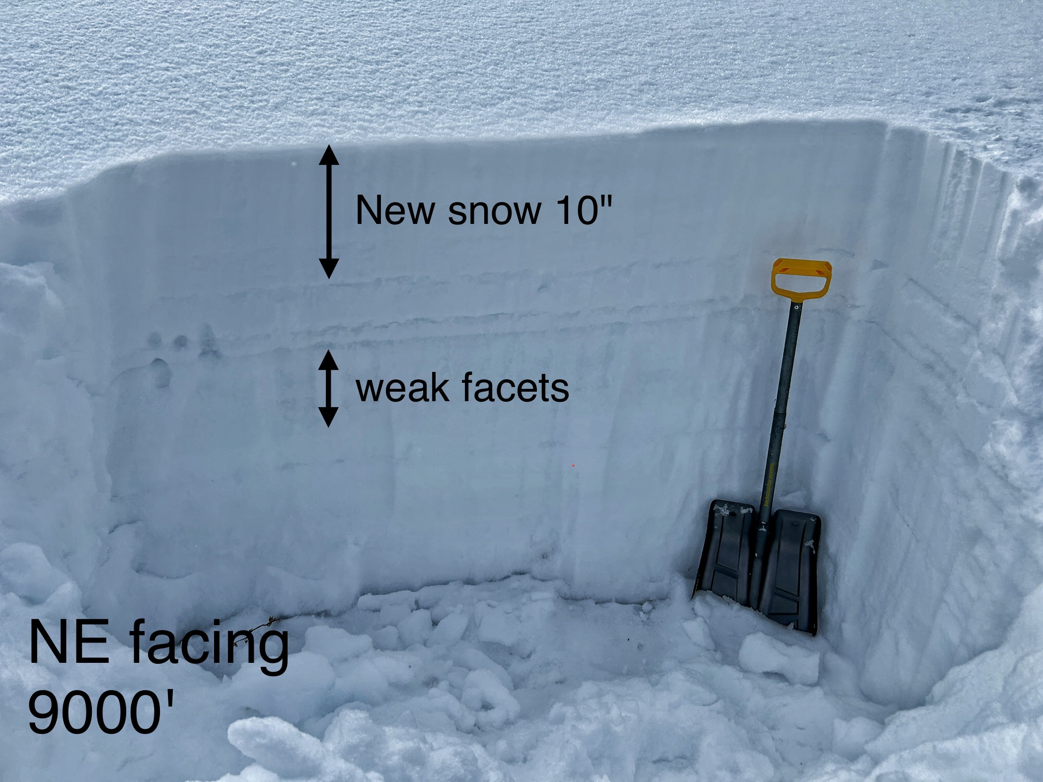
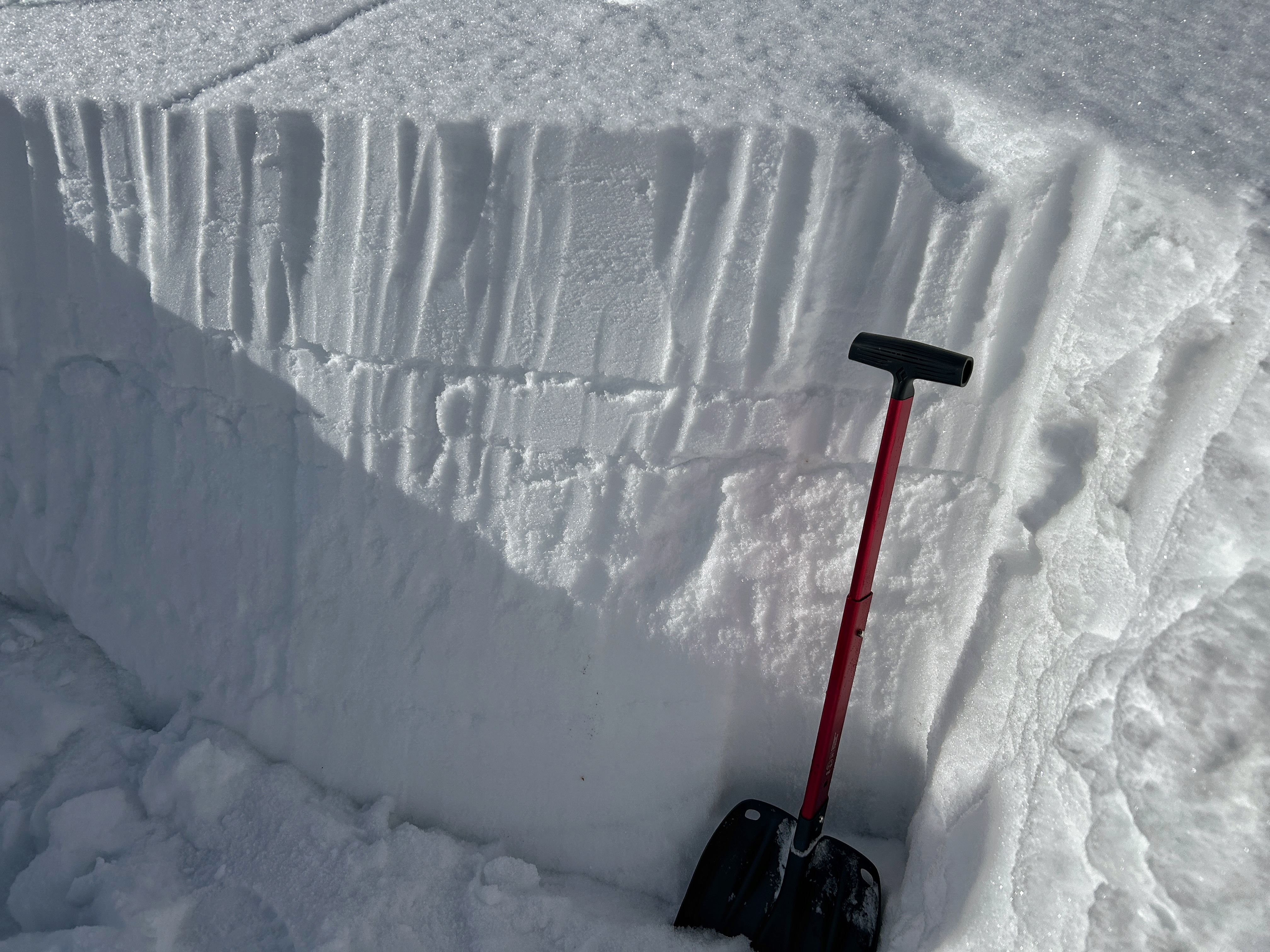
Surface hoar and near surface facets are now capped by this weekend's snow. The layers are buried 2-4" deep in the Black Canyon area of Island Park. Photo: GNFAC
-
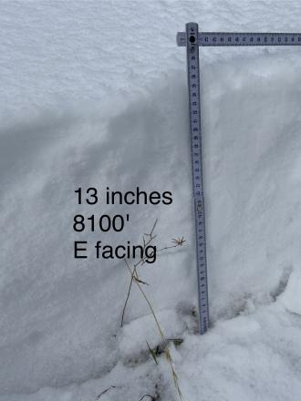
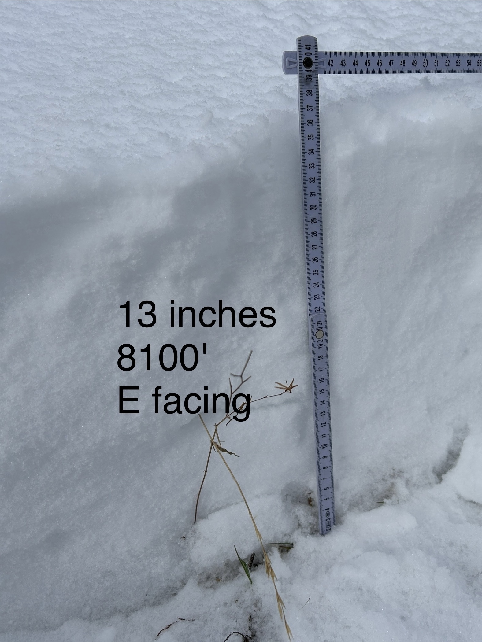
WE facing snow at 8100 ft Cabin Ck


Videos- Island Park
Weather Stations- Island Park
Weather Forecast Island Park
Extended Forecast for10 Miles ESE Lakeview MT
Overnight

Low: 53 °F
Slight Chance
ShowersWednesday
High: 79 °F
Sunny then
Slight Chance
ShowersWednesday Night
Low: 49 °F
Slight Chance
T-storms then
Slight Chance
ShowersThursday
High: 71 °F
Sunny then
Slight Chance
T-stormsThursday Night
Low: 43 °F
Slight Chance
T-storms then
Partly CloudyFriday

High: 68 °F
Sunny
Friday Night

Low: 47 °F
Mostly Clear
Saturday
High: 74 °F
Sunny
Saturday Night
Low: 50 °F
Mostly Clear
The Last Word
We ended our 35th winter in operation after 141 forecasts and ZERO avalanche fatalities, the second winter in a row with no avalanche deaths. The last time this happened was 1988 and 1989. It’s been an incredible season.
Thank you for all your support! Our success is directly related to support from our community and the Forest Service. Thanks to the readers of the forecast, everyone that sent in observations, took an avalanche class, or donated money, time or gear. Have a safe spring and summer!